What a ride this was. We have done the Snowys loop 2 years ago, but having six other bikes joining us all the way this time, made it so much more enjoyable. Most of the bikes that took part were "adventure tourers", so they were able to take their bikes off the tarmac and enjoy the best that the landscape had to offer on dirt tracks and fire trails then sharing their experiences with us over dinner and drinks.
This trip to the Snowys, saw us take a different route, through Bateman's Bay, Narooma, Brown's Mountain and Dalgety, where as last time we got there through Taralga and Goulburn. Both excellent rides but it's great to change things around to keep it exciting.
Day1: Map (248 kms travelled)
We all met at McDonald's Heathcote for coffee at 8:00am with a planned departure for 8:30am. All up, there were eleven bikes. Seven of us doing the whole trip, two of us joining the group for overnighter to Bateman's Bay and two others who took part in a day trip to Shell Harbour (our first stop) then onward to a route of their choice.

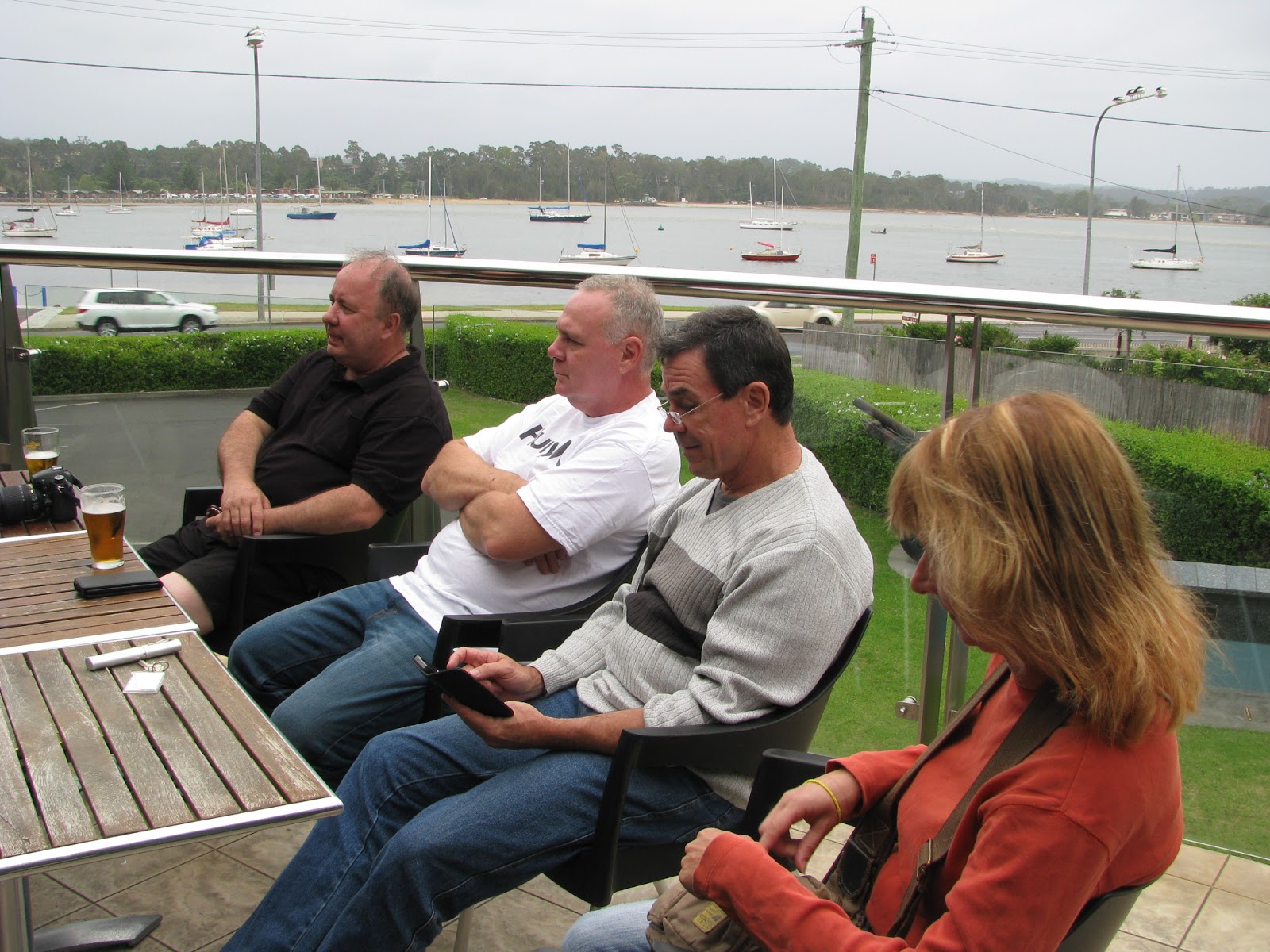
Here's a couple of the boys in deep discussion with Graham's BMW in the foreground.

The view from the deck of the pub where we shared a drink.

Mick and Christina enjoying the sunshine.

These two were there too......again.

As you can tell, we weren't in any rush as today's ride didn't require much travelling time.

Here's Graham pretending to know what he's doing and Ed supervising.

As always, the view overlooking the water is superb.

From Shell Harbour we depart once again and stop briefly for a photo stop at Gerringong.

Group shot.

Gerringong has some of the best coastline and scenery the south coast has to offer due to its sandy beaches and the mountains close proximity to the coast.

Leaving Gerringong, we follow the back road to Nowra, which eventually follows the Shoalhaven River, then on to Mollymook Golf Club for lunch. This is the view from the car park. Hard to take isn't it?


Ed and Lance, enjoying a laid back drink.

As always. we enjoy lunch on the verandah outside.

Well, why would you sit inside with views of the coast like this ?

That's Graham on the left, letting his lunch settle before getting back on the bike.

We arrive in Bateman's Bay in the late afternoon and check in to the Mariner's Lodge Hotel. This is what you get for $120 a night in peak season.

The view from our balcony.

Bill and Lance, our neighbours. I reckon a couple of their bottle tops were thrown at our window late that night, but I can't prove anything ...... Bastards!

Across the road, is this Soldier's club where we had dinner and drinks.

Also with a great verandah, to enjoy the view.

A couple of drinks before dinner.

Dinner at the bistro. Don't look so surprised Christina!

Anyone who follows our blog would know that lots of food is always on the agenda on all our rides.

Day 2: Map (389 kms travelled)
The next morning, we were met with this bloke exposing himself on the verandah..........Andy is that you ?

The weather was overcast with some fine drizzle, but no problem.

This shelter on the wharf has a table and chairs on it. Perfect for a quiet meal and chat.

This little ferry does cruises up and down the river. We must do that one day.

Looking back toward the pub from the bridge end from the walkway.

I found this plaque, explaining the name of the walkway.

From Bateman's Bay, the five guys on adventure touring bikes, left to take a more adventurous, off road route to Jindabyne, while Cathy, Ed and I stuck to the tarmac.
From Bateman's, we travelled in light misty drizzle through Narooma, then on to Brown Mountain and Bemboka. Brown Mountain is really pretty but very dangerous. Just ahead of us, close to the top, a car travelling down the mountain, took a corner too wide and side swept another car going the opposite direction in thick fog. This was probably the worst of the weather, because as we came over the other side of the mountains, the weather cleared perfectly and made for a more relaxing ride through Bemboka, before turning off to Dalgety and Jindabyne.
Here we stop in Bemboka for a pie and drink.

Bemboka's grocery store.
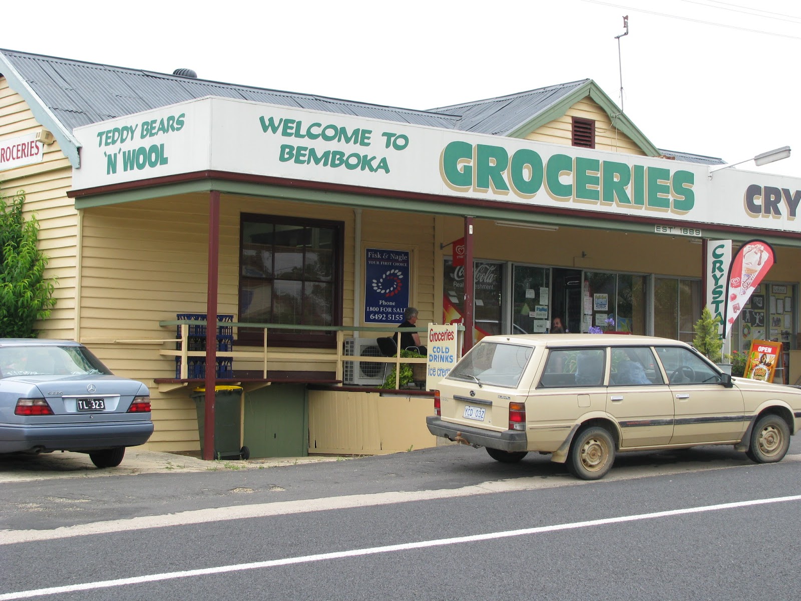
We love these little country towns.

We can't pass a country bakery without trying their goods.

Hmmm too much choice.

Cath and Ed, enjoying a break.

See? More food !!!!

We could've just sat there for a while and enjoyed the quiet atmosphere.

This sign was just at the turn off to head toward Dalgety.

Before Dalgety we spot this tiny railway stop.

Jincumbilly Station was used mainly for the transport of sheep.

Here's Ed, going in for that special shot.

I love this pic because it captures the area we rode through, perfectly.


Farmers and their huge letter boxes.

"Nice and slow Ed, so I can get a good clear shot"

Traffic? What traffic?

We could see for long distances ahead, just like this shot, so we could use the whole road to ride on. Soooo enjoyable, we absolutely loved it.

Here we arrive at the Buckleys Crossing Hotel in Dalgety.

As always, the lunch at the pub is yummy and reasonably priced.

I just had to photograph the bar inside. (Gotta love the sign)

This sign stands outside the pub.

The Dalgety Bridge, crossing the famous Snowy River.


I just couldn't resist taking a closer look.

So much old time character and charm.

This showground is under the bridge, on the other side.

The Snowy River.

It doesn't look solid but it certainly is. So good to see.

Ed, Cathy and I arrived in Jindabyne at about 4:00pm and refuelled with the intention of heading out to Charlotte's Pass after a short breather and unloading our gear. Funnily enough, Lance, Graham and Bill arrived there at exactly the same time after taking a completely different route. After a some discussion, we all headed out for the short trip out and we were met with freezing cold winds and heavy mist but still a gorgeous place to see.

This is typical of the landscape out there, bare and wind blown.

The view down to the resort area from the lookout.

On the way back out to Jindabyne, we stopped a few times to capture some photos. There are several of these high mountain streams about the place, and all as scenic as the next.


We couldn't ignore the scooter.

Here's Ed talking to Christina and Mick, heading in to Charlotte's Pass as we were heading out.

I still say Cathy's head looks huge in that helmet.

Notice how good the roads are here with brightly coloured lines for better vision, due to the fog no doubt.

Christina and Mick must have thought better of it after talking to Ed and headed back out.
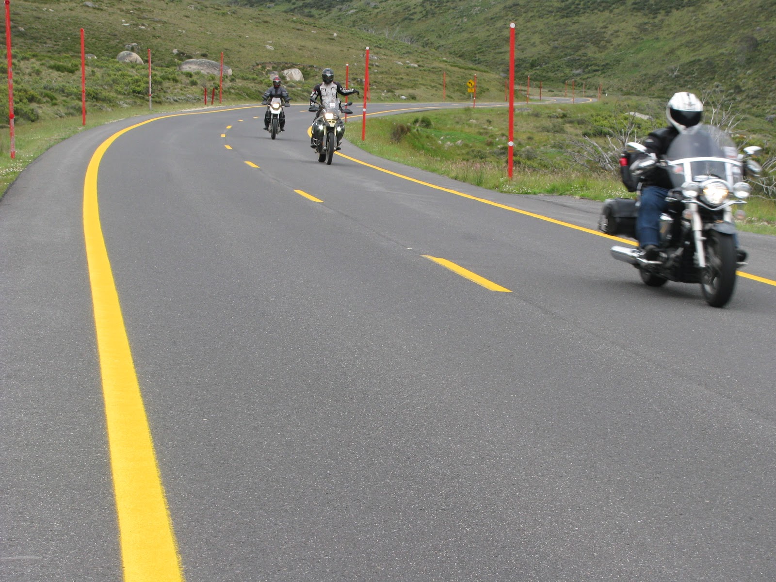
Brilliant winding roads all the way through the mountains.

I've photographed this chalet before with my iPhone, but this time I was able to zoom in better with a proper camera.


The view back to Jindabyne from the surge tank lookout.

Ed will go through all sorts of effort to get the perfect pic. No he's not asleep.

This is the entrance to the National park where the road crosses the Thredbo River.

Yes you may fish there if you have a licence.

The water was so damn clear and refreshing.


This is the bridge you cross to enter the national park.

This is the front door to Mad Moose's Guest House, where we spent two nights.

After an excellent day's riding, we all met back at the bowling club for drinks and dinner, then on for a good night's sleep.
Day 3: Map (316 kms travelled)
Day 3 is what it was all about, the Snowy Mountains Loop. You simply can't describe the roads and natural beauty this area has to offer, you just have to be there.
First stop Thredbo River, where it actually flows through Thredbo Village and its ski lifts.

Once again, the water is so pristine.


This is typical of the road winding around to Khancoban.Note the moss growing on the post.

The photo just doesn't do this place justice.

Leather Barrel Creek, is just another place you can stop for a picnic along the route.

It was such a top quiet spot to just sit and take it all in.

We could have sat there for hours and listened to the stream

Further along the route we caught up with the others at yet another rest area.

This is the spot on the route where the rest area is.

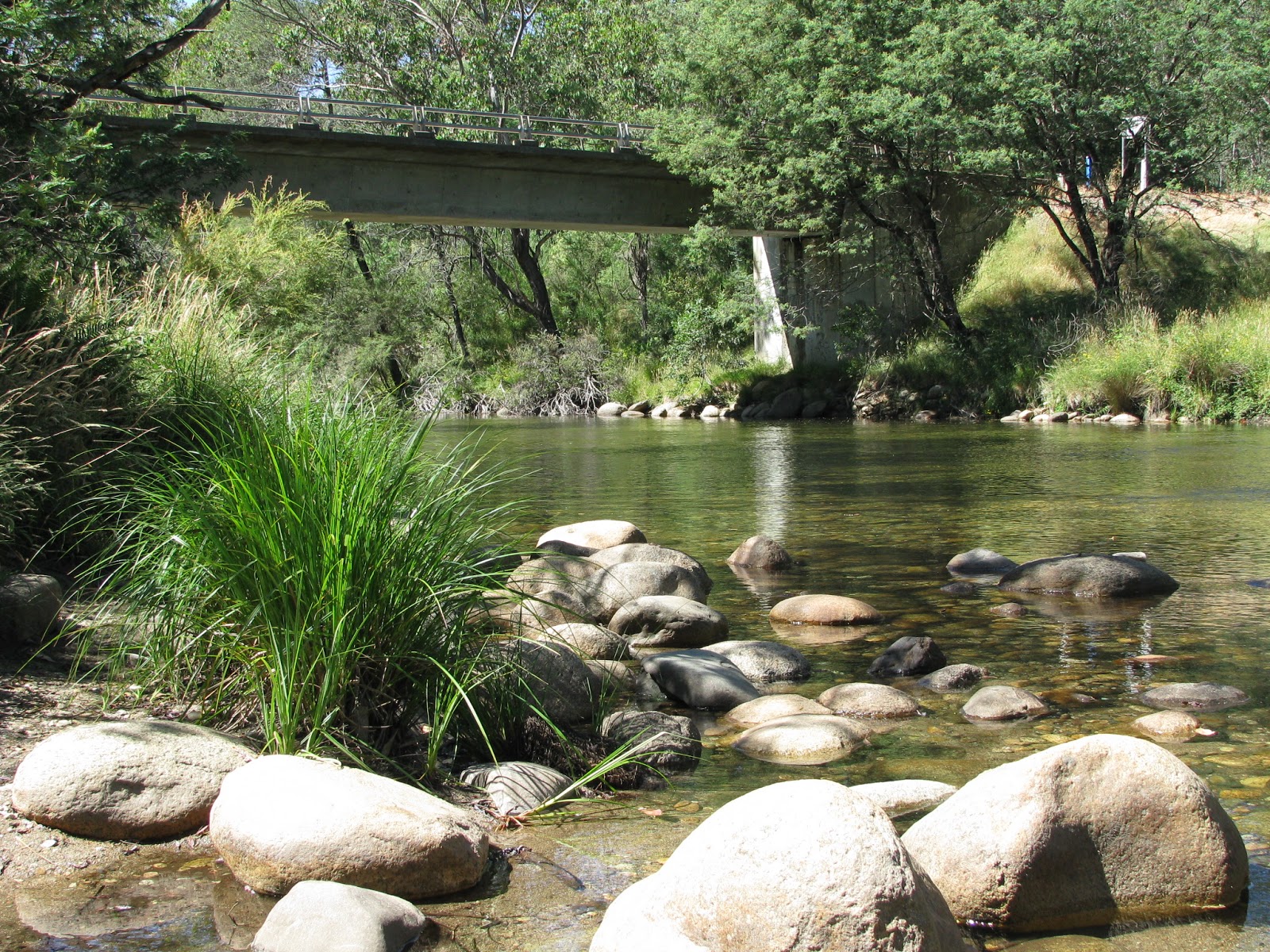
And it's on the banks of yet another river.

Another picture perfect spot.

This shelter is where the picnic tables are. They've gone through alot of trouble and expense keeping it in line with it's surroundings and heritage.

This area is the Tooma Dam, on the way to Cabramurra.

That bridge passes over the spillway.

There's that moss again, with the Tooma River in the background. A lot lower than we remember 2 years ago.

Do you ever wonder how they move a rock this size and position it where and how they want to? By the way, Cathy's head looks much smaller now.


A little further on, we meet up with Graham and Bill at this hut which serves it's purpose in snow storms and bad weather.


I don't know what the hell he's praying for? .... Bloody mad Englishman! Actually, he may have been praying for a toilet, but sadly there was none......

Inside the hut we find a good size fire place, which has been used, and some kindling.

Not much else in there though.

One last shot of the scooter striking a pose.

This is Tumut Pond Reservoir, where we met up with all the others once again.

And they found someone to talk to.

Lunch at Cabramurra.

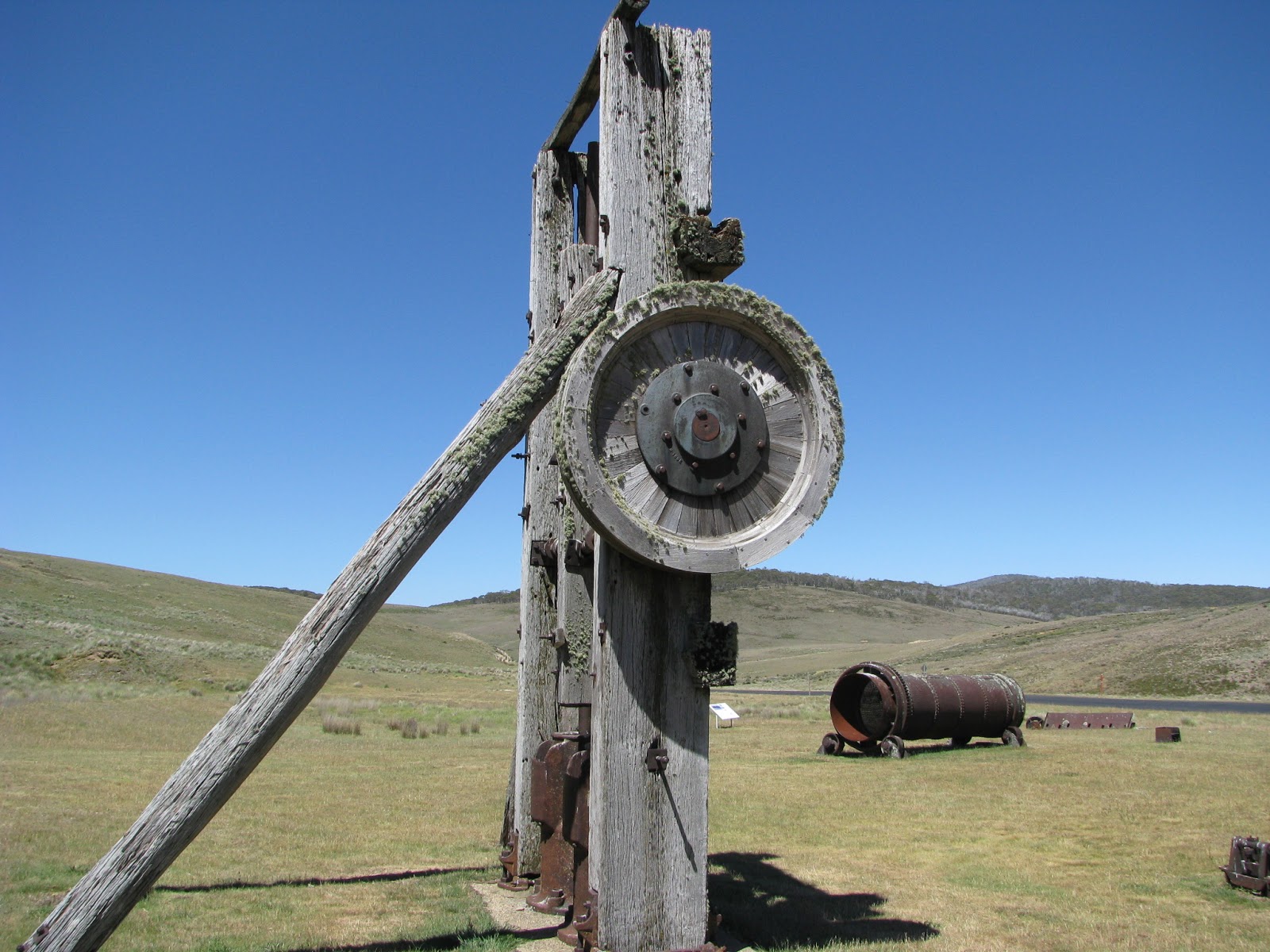
On our trip back to Jindabyne, we come across New Chum Hill at Kiandra where gold was prospected.

This is the old stamp battery, used to crush the rock containing the gold.

Reminds me of Romper Room. Oh look I can see Cathy.


I have ridden this section of the loop three times and I just have to stop at this spot every time.

The view is unreal and you can see the road carry on forever.

I have seen several caravans and campers stop by here, on that dirt track by the stream.

Ed liked this spot too. I could tell by the way he was snapping his camera.

So quiet and peaceful.

Our day ended around 5:00pm and after a rest and a shower, we headed off for tea at a Persian Restaurant in town. It came recommended by Mick and Christina.

Day 4: Map (500 kms travelled)
After breakfast at the local bakery, we decided to head off quite a bit earlier with Ed, Graham, Mick and Christina, so we could try a diversion through the little town of Nerriga, west of Nowra. Lance and Bill left at 6:00am due to commitments in the afternoon and we got moving at 8:00am with our first stop to refuel in Cooma.
Parked outside the Bakery.

This is the road to Nerriga via Tarago with Graham passing by.

And then Ed. The country side out here is so different from what we've been experiencing the past few days.

Apparently the farmers out here are expecting large volumes of mail. Or they don't check the mail for weeks on end.

Again, more peace and quiet.

Oh, so that's what the road was called.

Here we cross the Shoalhaven River, before Nerriga.


Another photo op.

There was a family swimming here and it looked so inviting.

Finally, we arrive at the Nerriga pub for lunch.

Not much to look at but it certainly did the job and they were very busy .

After lunch, we all went on to Nowra together and refuelled, where we then said our good byes to Graham and Ed. Mick, Christina, Cathy and I went on through Kangaroo valley where it was cool and very pleasant to ride in to. More importantly, very little traffic.We then carried on through to Picton, where we said goodbye shortly after and thus ending an excellent trip with great friends.
All up, Cathy and I rode over 1500 kms on this trip, 100 kms less than last time, go figure.
Can't wait to do it again.